South then North to Perth

Friday, 31 May 2013

Margaret River

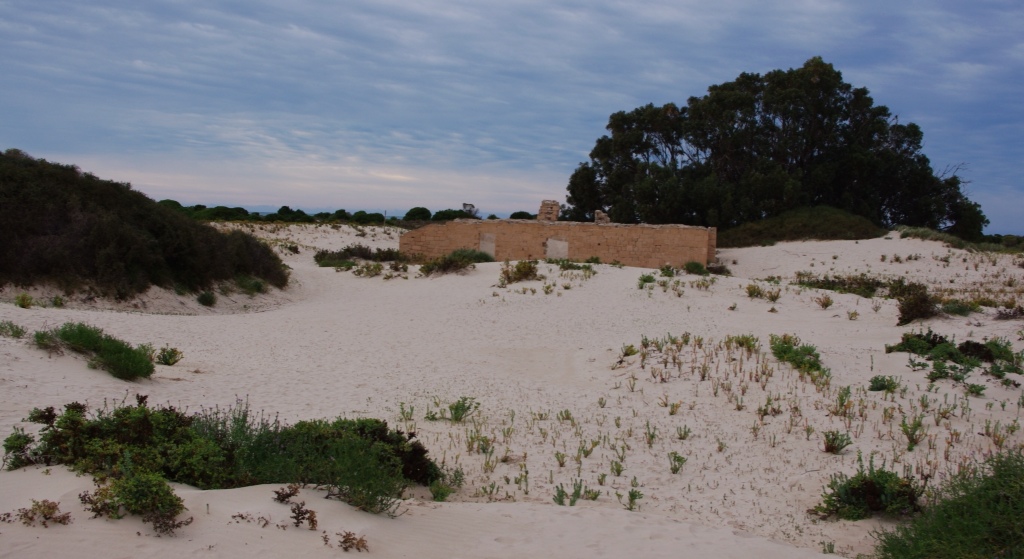
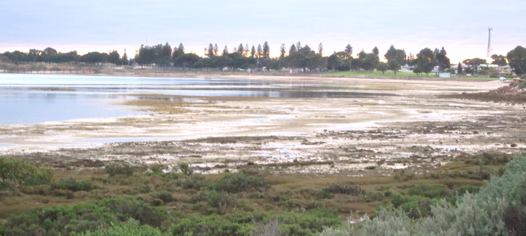
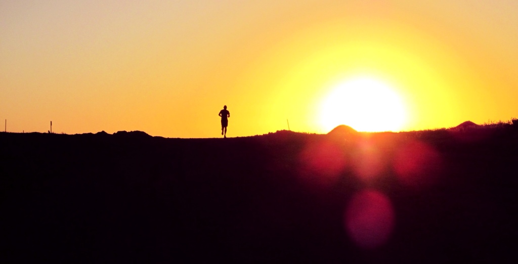
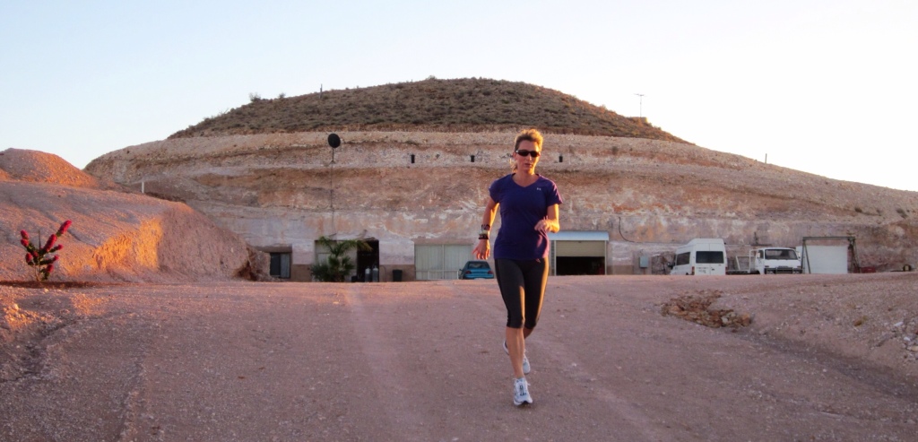
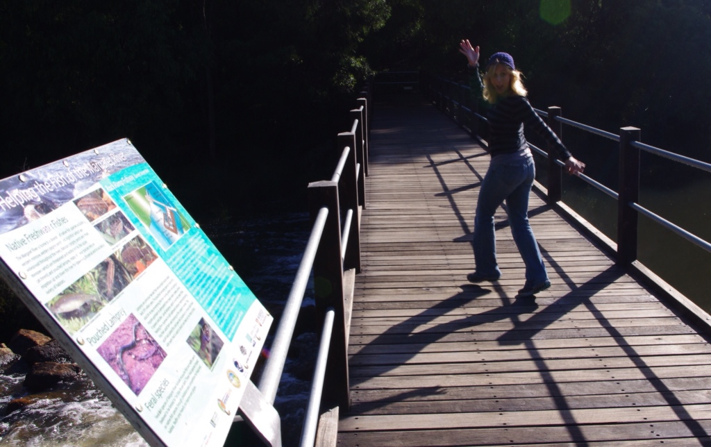
Running path to the river.

This morning the sun was determined, and it attempted to appear even though a light mist was raining down. Having slept in my running clothes last night, I was just as determined and very ready for the run this morning. The slight chill in the air would not keep Hector or me inside. We ran off from our little cabin at the Riverview Park and took a right down the dirt road to the Margaret River. Crossing the bridge we watched a smokey mist rise from river like floating ghosts.

Once on the other side, we were able to run parallel to the river for a few kilometers. Eventually the trail veered and we ran along the Ten Mile Brook trail and turned around after 3.25 kilometers. Then, we retraced our route back. Our total run this morning was 6.5 kilometers.

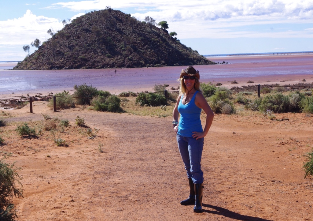
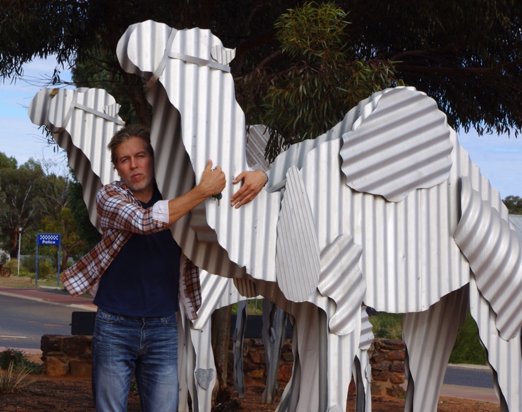
I forgot to take our camera on the run, so we re-enacted it after our showers…


After our showers and re-enactment, we were off to the Margaret River Bakery for breakfast. This bakery is quite charming with its hanging chandeliers and red, green, and tan oversized cushioned chairs. The fresh oj and shared veggies panini hit the spot, and we agreed that we would be quite happy to spend the entire day in this cozy bakery. But, we moved on to explore the region. (This area is very picturesque due to the numerous vineyards splattered everywhere.)

Augusta

While heading south, we stopped in the town of Witchcliffe at the Witchcliffe Candle Gallery. The candle display was surprisingly small, regardless we bought a $9 vanilla candle and chatted with the candle maker.


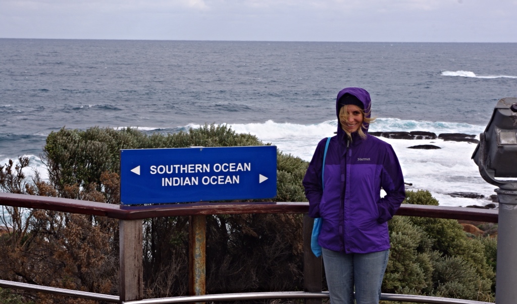
Our next stop was the Cape Leeuwin Lighthouse near Augusta. The lighthouse is located at the most south western point of Australia, where the Indian and Southern Oceans collide. I was surprised that we were a little over 5,400 kilometers from the South Pole…we had already driven further than that on this trip! Oh, and the lighthouse stands at 39 meters and is the tallest on Australia's mainland.

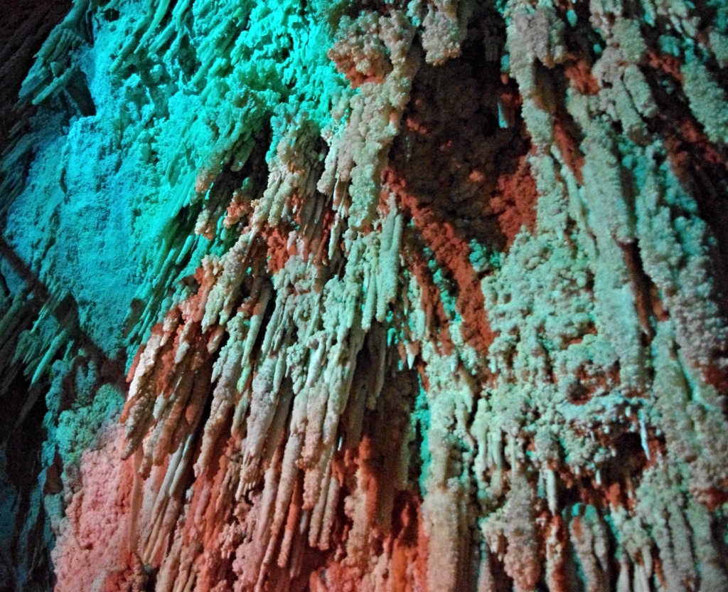
As we departed Augusta, we decided to take a different path and head north along Caves Road. Apparently caves lie everywhere in this region! Caves! I love exploring caves, so I was excited to have the opportunity visit a few caves in an area with 100's of unexplored caves. What a dream! The first cave we visited was Jewel Cave.


This cave was extremely impressive and the best cave I have ever been in! Holy long straw stalactites! The diversity of formations were beyond belief…definitely felt like we stepped into a jewel box with pendulites, helictites, massive stalagmites and flowstones. (The cave had a gorgeous display of cave coral too!). The pictures do not show off the beauty of this cave very well, but worth posting a few.

Cave coral.
The jewels in Jewel Cave.

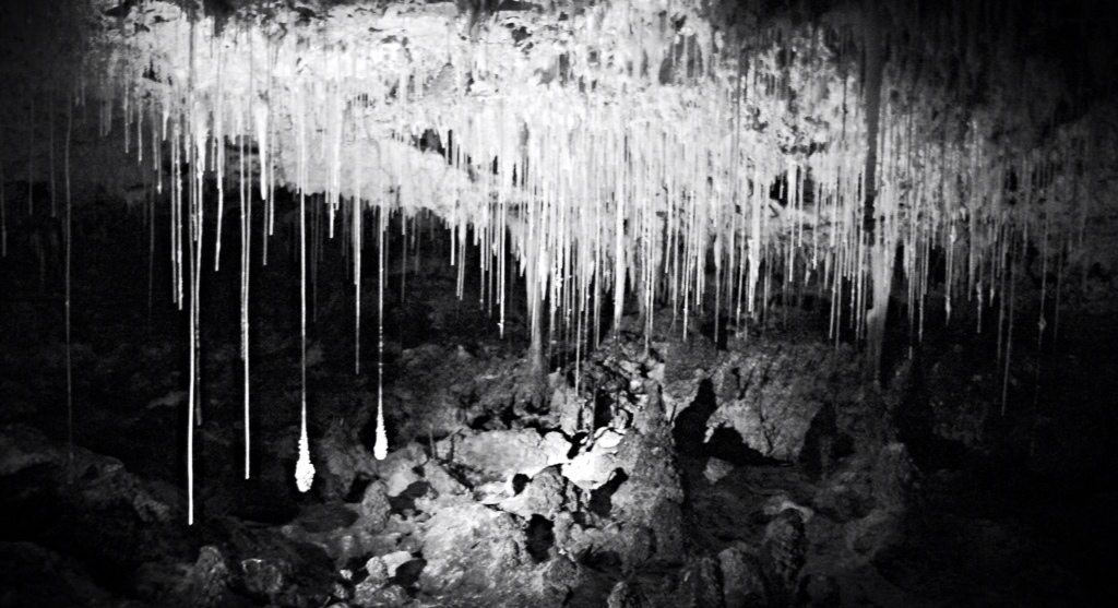
Pendulites in black and white.


The caves in this area were formed by water carving and flowing through the limestone. It was interesting to learn that the remains of many giant creatures have been found in the caves, including lions, wombats, kangaroos, and even the Tasmanian Tiger.

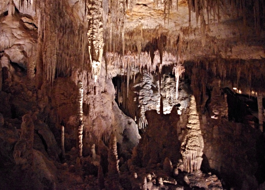
The second cave on our visit was Mammoth Cave. We took the self guided tour through this giant cave. It was surprising that we were allowed to wander anywhere we desired.


Mouth of Mammoth Cave.


After our cave tour we started running into darkness, and we didn't have time to visit any of the wonderful wineries in the area. It was okay because we still have about a dozen bottles of Australia wine with us in our supplies. No shortage any time soon…

As we continued north, we took a coffee break on Victoria Street in Bunbury. Victoria Street is also known as the Cappuccino Strip. It is designed to recognize Bunbury's beginning as a port settlement. We enjoyed the maritime highlights of the town and wished it were earlier in the day so we could see more. But without light, we felt the need to get to Perth.

Arriving in Perth well after dark, we found a fabulous hotel at the edge of the city (http://perth.frasershospitality.com), made some miso, and headed to bed. Tomorrow the plan is to sleep in, run, sightsee, and run again!


Drove 413 kilometers.

Ran 6.5 kilometers.


Margaret River

Thursday, 30 May 2013

We woke up to another rainy morning. Despite the heavy showers our ute was still caked with mud from the previous day. But, it will have to stay that way for now.

Today, we had a short voyage from Narrogin to Margaret River. Skipping breakfast in Narrogin, we detoured into Collie for lunch.

Collie (population 7,084)

Collie is not far from Perth, only about 215 kilometers, but it is rural and located near or in the only coalfield in Western Australia. Therefore, it is no wonder that it is a coal producing town.

The town is named after the Collie River, which is named after Dr Alexander Collie. Unfortunately, I haven't figured out who Dr Collie was or his significance.

The vibe in the town is a bit depressing. It is no wonder that Collie was once referred to as a “dirty mining town.” Although, it strives to be a top Australian tidy town, I felt it has some more work to do. The saddest part of this town was the number of unhealthy people. I wonder if it has to do with the coal industry? Or maybe something in the water…

Margaret River (population 13,000)

Everything really changed as we neared the coast. Driving south from Bunburry to Margaret River felt just like driving somewhere back home in Virginia with its tree-lined divided highways that passed along horse farms and orchards. Very pretty.


Arriving in Margaret River, we found a nice cabin along the river http://www.riverviewtouristpark.com/. We settled in and drank some wine while happily watching the rain fall down. Once it slowed we got outdoors and figured out where we would run in the morning. Can't wait!

Drove 305 kilometers.

Ran 0.


Hyden – Home to the Wave

Wednesday, 29 May 2013

Hyden (population 365)

Heading towards the dark rain clouds, we drove the back road from Southern Cross (population 1,100) to Hyden to see the giant wave. A few skippies hopped across the road ahead of us and the rain poured down. The road got muddy and our VW ute went from a glossy black to an earth red, as we splashed through the puddles.

Our dirty VW Amarok


Hyden is the gateway to a giant granite rock known as Wave Rock. We entered from the back of the town along the Yellowdine Southern Cross Road, so our first stop was the rock.


Wave Rock is 15 meters tall granite rock, and standing at its base really feels like a giant wave is about to crash down on top of you. The sign at the site says the rock is believed to be 2,700 million years old.


Hector and I decided to take a hike up and around the giant monolith. We walked and climbed everywhere possible. It was fun to walk over the cracks and puddles formed in the granite.


Tin Horse Highway


After our wave rock visit, we stopped at the local bakery. I picked up the visitor guide and discovered that between Hyden and our destination, Narrogin, there is a highway known as the Tin Horse Highway. It didn't take much convincing to get Hector to drive it. Hilarious! The local community of Kulin has a tin horse art competition each year to promote the Bush Race (which I think is a horse racing event) and designated this road to showcase the quirky horse art.

Here are a few photos of the artwork…

This year's winner, Usian Colt.

Narrogin (population 5,500)

We arrived at Narrogin, the commercial center of the wheat belt region, just before 6 p.m. and found out the town rolls up the carpets at 6. A bit surprised, we tried to get into Coles supermarket at 6:05 with no success, so we went back to the Narrogin Motel…AND I would tell you more, but I already forgot.


Drove 406 kilometers.

Ran 0. Hiked 4 kilometers.


Menzies

Tuesday, 28 May 2013

Kalgoorlie (population 30,000)

Lake Ballard

We woke up to heavy rain and it continued to rain and rain. Our plan was to drive up to Lake Ballard to run through the sculptures, known as Inside Australia, created by Antony Gormley, a British sculptor. If the rain was falling in the north we may not be able to access the lake, because it is located 50 kms down an unsealed dirt track. Our first stop this morning was the visitor information center to check road conditions.

By the way, a significant gold find by a man named Paddy Hannan happened, guessing over 100 years ago, in the Kalgoorlie region. Then, thousands of hopeful miners flocked to the area. There seems to be mines everywhere, including a very ugly and unbelievable super pit.

The Kalgoorlie visitor center employee checked with the visitor center in Menzies about the roads. The roads around Kalgoorlie had just been closed, but in the north the roads were still open, so we grabbed a bite at the local muffin shop and headed north.


Running the Menzies Sculptures

Menzies interpretive trail…in the early 1900s more than 10,000 people lived here. Now there are only about 60.


The area north of Kalgoorlie is called the Northern Goldfields, because of the towns established during the gold rush era. Menzies is one of these towns.

Arriving in the town of Menzies, we checked with the information center and found out the 50 kilometer road to Lake Ballard was open. By this time the weather was clear and beautiful.

The dry lake looks wet.

The sculptures are brilliant! In 2003 for the 50th anniversary of the Perth International Arts Festival, Gormley placed 51 sculptures of the Last Nomads across the giant dry (today…not so dry) lakebed. These sculptures made of molybdenum, vanadium, and titanium alloy represent the Menzies inhabitants. The story is that Gormley scanned 98 naked inhabitants with 3D technology to produce realistic sculptures. On the lakebed, sculptures existed further than our eyes could see. We really enjoyed having the entire place to us and the 51 sculptures.


Due to the rain, the white salt surface of the lakebed turned to dark red mud. If the surface was dry, then the running here would be beyond phenomial. But today, the running was slow and slippery…we decided not to even bother changing into running clothes and slogged a few kilometers from inhabitant to inhabitant. I did get to try out my gumboots! Hectie, who kept giving me a hard time about bringing the boots, had to travel the muddy surface in his bare feet. Ha…the best $14.95 I ever spent!


Moorine Rock Motel


After stopping at Kalgoorlie Woolies for a few supplies, we drove for a few hours in the night to the Moorine Rock Motel, located 20 kilometers west of Southern Cross. We were greeted by a friendly man in the pub, who happily assisted us with a lovely motel room. Not too long after check in we were sound asleep as road trains breezed by our little place along the Great Eastern Highway.

Drove 611 kilometers.

Ran 4 kilometers (sort of).


Kalgoorlie – The End of the Nullabor

Monday, 27 May 2013

Balladonia, Home of the Skylab Crash

Balladonia has some interesting history. The name comes from the Aboriginal people and means big rock by itself. We didn't find the big rock, but didn't really look either. From 1897 to 1929, there was a telegraph station here, which was part of the Perth to Adelaide line. The telegraph line to the south along the coast was having problems because the sea spray from the Southern Ocean kept shorting it. Therefore, the Aussies built a line a bit further to the north.

The town was unable to grow because the climate was too arid and water sources were scarce. Even today they haul all the water in from Norseman.

A piece from the Skylab. Real or not?
 

In more recent times, the area made the news (in 1979) when the Skylab space station re-entered our atmosphere and left its debris all over the Balladonia area. They even have a piece if it in their little museum at the roadhouse.

And…first thing in this morning, Hectie and I went out to try the Skylab golf hole, par 3, 175 meters. Balladonia is very small, so we didn't have a running option (we probably could have found somewhere to run, but golf seems to be our focused now). We decided golf was the next best thing, so we thought… Three lost balls later we finished the “saltbush ball-eating hole” with horrific scores, 8 hits for the both of us. We decided that cappuccinos would lift our spirits and then got back to the road. The cappuccinos were very awesome!

Our photos showing how we felt after this ball eating hole!


Fraser Station

Entrance to Fraser Station.
 

Then, our spirits were lifted more when we arrived at the Fraser Range Sheep Station, a very tranquil location in the middle of the world's largest eucalyptus hardwood forest. First stop was at the historic stone shearers quarters to get the clubs. Then, we went off to the tee. Gorgeous! The Sheep's Back hole is par 3, 141 meters. Although I lost again: Hector' 7 to my 8…I just was too happy to care. It was a true oasis paradise!

 
I am happy here!

Fraser Station was very peaceful.


Norseman


Norseman, where we were suppose to reach last night, is a historical gold mining town. Funny legend: one night a long time ago, Prospector Sinclair's horse, Hardy Norseman, dug up a nugget of gold by pawing at the ground. So, the town got named after the horse.

Hector and Hardy Norseman

It is now the home to the tin camels and a statute of Hardy.


While we were at the post office and the Caltex station, we heard stories about the mine laying off most of its employees. The town was quiet and those remaining are packing up to move on. If another mine doesn't takeover then Norseman's fate might be a ghost town.

Gold mine at the edge of Norseman.

We located the two golf holes at an abandoned golf course left to dissolve back to dirt and salt brush. It was sad and scary at the same time. It felt as if at any moment a man in a terrifying mask would jump out and attack! But the eeriness did not keep us from playing. The Ngadju hole was par 4, 354 meters and the Golden Horse hole is par 4, 436 meters. Neither of us were close to par; I will just leave it at the fact that Hectie beat me on both holes, no balls were lost, we actually gained a ball, and we were not killed by a madman.

At the golf course….where is everyone?

A kiss to Hardy for keeping us safe at the abandoned golf course.


Kalgoorlie

Happy to not have stayed in Norseman the previous night, we drove on to Kalgoorlie. After we checked in to The View on Hannans (www.theviewonhannahs.com), we walked to dinner. On walk to the restaurant we found out our room was located right next door to Australia's oldest working brothel, Questa Casa. I tried to peek in and found out they have daily tours at 3 pm each day. Not really interested…

Dinner at Lemongrass, a Thai place, was good, especially since I was very hungry.

Drove 406 kilometers.

Ran 0 kilometers.


Chasing the sun to Norseman

Sunday, 26 May 2013

Border Village

I believe we have discovered the armpit capital of Australia, Border Village (and I believe it to be worse than the U.S. armpit capital). Everything is surreal here…cops everywhere (checking for drugs, drunk drivers, and people sneaking in fruits and vegetables). With so many cops, I wasn't sure if I felt safe or not!

We woke up this morning to the fragrant smell of cattle trucks filled to the brim with sheep (I think…my distance was kept due to the strong odor). This experience brought me back to memories of the summer I worked in Vale, Oregon. The cattle trucks and stockyards would hinder my daily runs by either keeping me from running or forcing me to run circles at the local track far enough from the smell enabling me to breathe freely.

So needless to say, there was no run today!

At Border Village, I took a quick snapshot of Rooey, the giant roo.


Eucla

Giant whale in front of the Emu Export lager sign.


After going through the quarantine again for a second vehicle inspection, Hector drove us to Eucla for fuel and a visit to the old telegraph station.

In 1841, Edward John Eyre (by the way we are driving the Eyre Highway) became the first explorer to visit the area. A few decades later, a telegraph line from Albany to Adelaide was created. Land was set aside at Eucla for a manual repeater station. The telegraph line opened in 1877 and Eucla was a conversion point. South Australia and Victoria used American Morse code while Western Australia used the international Morse code.

The town of Eucla was established in 1885 and peaked in the 1920s.

Old Eucla telegraph station buried in sand.

In the 1890s a rabbit plague hit the area and ate the majority of the dune vegetation. The dunes were no longer stable and large sand drifted to the town. The original town had to be abandoned, and a new townsite established in the same area as the giant whale…high up on a hilltop.

Telegraph station ruins.


Mundrabilla

We drove on to Mundrabilla station, the first sheep station on the Nullarbor, which was established by William Stuart McGill (a Scotsman) and Thomas and William Kennedy (two Irishmen) in 1872.


Time for more golf! Stopping at Mogas we picked up our clubs and balls for the Watering Hole hole. It is a par 4, 330 meter fairway. Hectie's first shot was a beauty. Mine was so so..a long roller. As we took a hike to find Hectie's ball, Hectie was sure he'd never see it again, but as we turned the corner we saw the white glow of it laying perfectly on the dirt. Hectie ended with 1 over par…very nice. Me, well a few bad putts put me further behind…5 over par. 😦

Madura

Next stop…Madura to play Brumby's Run. I kept wondering what is a Brumby? I found out Madura was settled in 1876 and used to breed cavalry horses for the British Indian Army for use in the Northwest Frontier region of India, which is now part of Pakistan. The land along the Nullabor Plain is extremely dry, and the Madura area was one of the only places with free flowing water. And learning something new, a Brumby is Aussie slang for wild horse. Why did I not know this?

Now, the surrounding area is part of Madura Station, a sheep station, but was previously used to graze cattle and camels…and of course, horses.

Looking down the fairway at Brumby's Run.

Brumby's Run hole is par 3, 125 meters. No specific highlights to report for this course, other than I found a few extra balls as I looked for my ball. Score: Hector had 4 and I had 5.

The Maldura Pass is a pretty spot and has a nice little cafe, so Hectie and I shared an order of fish and chips for lunch.

Anna waiting for lunch.


Our next Golf stop was in Cocklebiddy. We have now become obsessed with this dry dirty course, and played the Eagle Nest hole, par 4, 347 meters. It was wide and lacked vegetation, so a few long rollers got us both to the green quickly. Hectie achieved par, and with 2 bad putts I was over par by 2. Hectie wins again!

Eagle's Nest hole.

By the way, the Cocklebiddy area has underground caves, and the Cocklebiddy cave has a passage more than 6 km long, of which around 90% is underwater and only accessible via cave diving. Needless to say, we didn't head in.


Caiguna


The golf hole in Caiguna is located right before we got on the 90 Mile Straight. It is appropiately named the 90 Mile Straight hole, par 4, 310 meters. This hole was so bad that I have already forgotten it. I had 10 hits and Hectie made it in 6. Tough luck. I kind of wish this fairway was like the road we were about to drive, then things would have been simpler!

As I drove a few kilometers out of town, we saw a nice attraction sign for the Caiguna Blowhole. Turning off to go see it, we went head to head with a caravan on a narrow dirt road. Deciding I was the chicken I pulled off the road. The other driver stopped and told us the blowhole was no where to be found. Not believing him, we contined the search and…came up empty! Wtf…we drove for over an hour disturbing herds of kangaroo…to FIND NOTHING. We left after searching all possible routes and continued west.

Kangaroo near the invisible blowhole.

Here is a photo Hectie took as I passed an oversized truck on the straight.


Balladonia

Although we constantly chased the sun through two time changes, we weren't able to make it to Norseman before we lost sunlight. But, we were very happy to spend the evening in little spot known as Balladonia. It was so peaceful. The motel was clean and dinner of chicken, potato, and broccoli, was delicious. And, it meant we could play the Skylab golf hole in the morning.

Drove 549 kilometers.

Ran 0.


Somewhere on the border of South Australia and Western Australia

Saturday, 25 May 2013

Ceduna

View of Ceduna from trail.
 

Last night the clouds covered the night sky and we woke up to a warm morning. The conditions were perfect for a run, because temperature was nice and the wind was no where. We decided to run the entire 4km Encounter Coastal Track from the Sailing Club in Ceduna to Pinky Point in Thevenard and return…making it 8 kilometers.

Pinky Point

The Encounter Trail was dedicated to three worlds coming together (Aboriginal, British and French). The signs along the trail discuss the history of these worlds and their influences, native plants, and Aboriginal culture and relationship with the land.


Departing camp at 9:45 am, we stopped for coffee at the Ceduna Bakery. At the visitor center across the street, we found out the Wombat Rescue Homestead (which I really wanted to visit) was closed permanently to the public. Apparently the woman running the center dislikes people to the point she won't even take donations (at least that is what the visitor center employee claimed). I don't really believe him. By the way, the man working at this center was not friendly or helpful. Why in the world would you work at a information center if you aren't going to be friendly? Maybe he was having a bad day…oh well…off we went to Penong, home of 100 windmills.


Penong windmills


Golfing the Nullabor Links


Our friends, Chris and Kirsty, from Sydney told us about an 18-hole, 72 par golf course along the Eyre Highway (across the Nullarbor Plain). It is 1,365 kilometers from hole 1 to hole 18 (Ceduna to Kalgoorie)…making it the world's longest course. Hectie and I decided to play our first hole in Penong. Picking up the balls and sticks at the local Caltex, we headed to the “Windmill” tee, a 4 par 250 meter hole. Not being skilled as Tiger Woods or even a half way decent golfer, it took us a few more swings than just 4.


After several ball drives into the three trees existing on the pitch, Hectie's finally knocked it in in 9. For me, it was looking good until I accidentally ate a fly and fell off my game with 3 shots over the green..7 hits for me finally got my ball in the hole.


Oh and by the way, this course is supposedly made of little grass, lots of rock, dirt, and saltbush. Nature provides the obstacles. Apparently we need to watch out for the ball stealing crows on this course too…but my biggest concern is the gross tasting flies.


Fowlers Bay


Wanting to do some side trips today, we took a detour from the main road to Fowlers Bay. The only people there were the fishermen on the great jetty.


After our stroll of the jetty to have a better view of the pearly white dunes, we stopped at the shop and had lunch. It was so peaceful we felt like staying, but with still several hundred kilometers to go for the day, we got back on the road.


Next stop was Nundroo to play the Wombat hole, par 5 520 meters. All I can say about this one is holy rocky hill! Hectie took me on this one with the shot of the day! I fell behind with several bad shots. Hectie had 10 hits and I had 13…dropping me 1 behind overall. Tomorrow will be a new day! Can't wait, so fun!

This fun highway sign is located near Yalata.

We reached the border after dark and went through a thorough a quarantine search of our vehicle. Our plan was to stay in Eucla, but the only room available was a budget room with no bathroom. We decided if we couldn't find a room with at least a toilet back in Border Village we would just find somewhere to camp. That idea wasn't too appealing since the area is a thoroughway for travelers and road trains. Luck was kind of on our side, because we were able to get one of the two last rooms with bath. It was pricey ($160 AUD) for what it was and had three too many beds! There were four beds in this room and no floor space, but it had running water and a toilet. Yeay!

We skipped dinner and made miso with the water I boiled in Ceduna and went to bed at 9:30.

Drove 547 kilometers.

Ran 8 kilometers.


Ceduna, South Australia – Oyster Capital of Australia

Friday, 24 May 2013

Port Augusta

There was no run this morning. Instead, we drove down the street to JBs Radiator and Windscreen Repair to have our big windshield chip looked at and possibly fixed. Mr. Collins, the owner, said it did not look like it would crack further and his recommendation was no repair. Eventually, we will replace the screen, but for now we will not worry about it.

We departed Port Augusta without visiting the Arid Botanic Gardens. I love the gardens in Australia and am surprised I haven't tried to convince Hectie to visit all of them along the way.

Ceduna

On way to Ceduna, we were stopped near Kimba for a drug and alcohol test. Hector breathed into the little tube and passed with a zero reading. This police action is quite normal in Australia and is not Hector's first time to tube it.


After passing and being sent on our way, we drove 500 meters and saw a giant bird, the Big Galah! So we stopped and discovered we are halfway across Australia. Yippee!

The Big Galah.

Arriving in Ceduna at 4 pm, we found a wonderful caravan park, Ceduna Foreshore Caravan Park, and got a nice little cabin with views of the Murat Bay from the park.

http://www.cedunaforeshorecaravanpark.com.au/11274/Home/


Cabin at the caravan park.


Since Ceduna is the self claimed Oyster Capital of Australia, we grabbed the Tabasco and headed out to find oysters. Three stops and NO oysters, huh? How can the oyster capital have no oysters? We settled for takeaway from Bill's Chicken and Seafood, which, I might add, had no chicken! How can a restuarant have chicken in its title and have no chicken? We ended up with a grilled local fish, chips, and salad in a box, and took it back to the cabin to enjoy.

Tomorrow we will have a nice morning run along the Encounter Coastal Trail. This trail is close to 4 kilometers long and runs from the local sailing club to Pinky Point in Thevenard. Our plan is to run the entire length and back.


Drove 479 kilometers.

Ran 0 kilometers.


The Breakaways Reserve

Thursday, 23 May 2013

Coober Pedy


I have to laugh about my sleeping experience last night. I knew the room would be pitch black at lights out, and I was okay with it. But something else took me by surprise…the surprise came in the middle of the night when I woke up to a feeling of being buried alive! The combination of no air movement, pitch darkness and too warm p.j.s freaked me out. On the edge of an anxiety attack, I scrambled out of bed to flip on the bathroom light. Then, I located the rotating fan and flipped that on. Then, I removed my p.j.s and went back to bed in my tank top and undies. The breeze from the fan calmed me enough to finish the night with a restful sleep. 🙂

Upon waking, Hectie and I put on our running gear and headed outside. I was very happy to get out in the open space and full of air! This morning had a slight chill in the air, but that was not going to stop our run. We left our dugout at 6:15 am and headed out a dirt road leading to the underground Serbian Orthodox church.

Serbian Orthodox Church

Hectie ran to the top of the church outside, while I wound myself down the long hallway into the church. It was so quiet and lonely that I only stayed for a minute before unwinding and stepping back outside.

Inside the church.

Hector and I spotted each other and continued running together. The sun began to rise as we crested the hilltop and headed down the path past a bunch of old tires in a wash. Gorgeous run through the lunar landscape.

Sun shining making the colors of the earth so vivid.
Anna running in from of one of the residences. Image living here.
 

Our total run was 5 kilometers.


The Breakaways Reserve


Taking the advice of the B&B owners, Ken and Ana Males, we decided to take a detour to the Breakaways Reserve. And…it was well worth the 30 minute drive through the striking desert scenery.

Our path was flat, but bumps of colorful mesas peaked out from the ground. This area formed millions of years ago and is absolutely stunning…but today it was incredibly windy.

 
During our drive, we drove along the Dog Fence. It is the longest fence in the world stretching 5,300 kilometers from Queensland to the Great Australian Bight. It's purpose is to separate cattle areas from dingoes.


Tom's Working Mine

Mullock heaps near the mine. They surround the town.
 

Shortly after leaving the dirt road from the Breakaways, we turned onto Stuart Highway and stopped at Tom's Working Mine.


At the mine, we opted to go on a self-guided walk and were all by ourselves. We decided to try out some of the tools…not really. We did take some photos of us pretending.

And look what Hectie found…well, not really.
Oh, and noodling. We had the opportunity to search for pieces of opal in the dirt mound outside of the mine. We found nothing exciting, and decided it was time to head back to Port Augusta.


Port Augusta

The drive back was too eventful for one day, but I am happy to have the bad luck out of the way now. We hope to be in the clear for the rest of the trip. The first of the bad drive was due to all the dead cow laying on the side of the highway. Once I started counting, I counted 6 cow. Luckily, we were not the ones hitting these cow.

We did find out the main reason for the speed limit was to maintain a safe speed necessary to stop in time before hitting a cow. We learned this from the police officer who wrote Hector's $730 speeding ticket. Thank God it wasn't due to actually hitting one. By the way, I told him to slow down…now maybe he will listen. Be safe Hectie!

Shortly after the ticket, we stopped in Glendambo to switch drivers. There is not much to this town, but there is a roadhouse. Once on the road, a rock that felt like a boulder hit the windshield. After a shriek, I looked at Hector and said, “this drive is not so good.” Now I couldn't wait to get to Port Augusta. I just wanted off the road!

So as Hector fell asleep, I decided to not stop at Woomera. Woomera was established in 1947 as a launching site for British rockets. Between 1960 and 1972, NASA operated a deep space tracking station. It might have been an interesting stop, but I was not taking any chances. We rolled into Port Augusta, found a room at the Standpipe Motor Inn and had the best Indian food ever!

Drove 612 kilometers.

Ran 5 kilometers.


Coober Pedy, Opal Capital of the World

Wednesday, 22 May 2013

Coober Pedy

Entrance sign to Coober Pedy.

We were able to leave Port Augusta before 10 am. I was so excited to be driving to and visiting Coober Pedy today! It is an underground town built in the dugouts from the opal mines. According to the 2013 Coober Pedy visitor guide, WWI soldiers shared the idea of dugout living here upon returning from the trenches. Apparently, the advantages of living in the ground are the constant 23 to 25 degree celsius temperature. The guide also reports that fifty percent of the population in Coober Pedy live underground.

For me, the real attraction are the OPALS! And soon we would become noodle-ers!

But before we could get to Coober Pedy, we would need to pass Jeepers Creeper AGAIN! We spent all of the previous day unintentionally traveling with this strange vehicle, and it looked like today would be very similar.

We arrived on the moon, oops I meant Coober Pedy, around 3:30 pm. Jeepers Creeper was not far behind! We checked in to the Underground B&B http://www.undergroundbandb.com.au/ after talking with owner, Ana. She had an impressive collection of opals which her and her husband, Ken, mined…so colorful and brilliant.

The front of the Undergroud B&B.

Our room for the night.
 

By the time we got settled into our stunning dugout darkness had arrived, so the run for the day was exchanged for a pizza at John's Pizza. Great pizza!

Another photo inside our dugout.
 

Drove 566 kilometers.

Ran 0. 😦